Recommended

Skip Navigation LinksHome / Search

Search

 
Results Per Page

Found 4 results for Virtual Earth.
Date between: <not defined> and <not defined>
Search in: News , Articles , Tips , Shows , Showcase , Books

Order by Publish Date   Ascending Title   Rating  

  • Databinding Shapes with the Bing Maps Control for Silverlight

    0 comments  /  posted by  Silverlight Show  on  Nov 05, 2009 (7 months ago)
    In this post David Burela explains how to use the Bing Maps control for databinding.Image

    There is code available on the Microsoft website that adds dependency properties to the Bing Maps control which expose ItemsCollection, ready for you to databind to. If you combine this with some custom datatemplates, you are able to databind directly to the map as you would expect.


  • 0 comments  /  posted by  Silverlight Show  on  Nov 02, 2009 (7 months ago)

    Storm Ideas has completed a rich interactive mapping application and web site for the Scottish Government, visualising a wealth of data for the Scottish Index of Multiple Deprivation (SIMD).Image

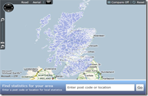
    The SIMD identifies concentrations of deprivation across Scotland. Indexing these areas allows effective targeting of policies and funding with the aim of focusing on concentrated areas. The mapping application incorporates a broad range of data indicators covering areas such as income, health, education and crime and is publically available through the SIMD website.  In addition, it is hoped that the application can be shared and adapted for use by stakeholders both within the Scottish Government, and Local Authorities and NHS boards.

  • Data Binding with the Virtual Earth Control

    0 comments  /  posted by  Silverlight Show  on  Mar 23, 2009 (more than a year ago)
    Michael S. Scherotter has a post about one really new Silverlight control - Virtual Earth Control.

    When I started looking at the VE control, it was apparent that the control was missing some features related to data binding:  I wanted to bind the coordinates returned from the Stores Service to shapes in the Map Layer, use a data templates to define what each store shape would look like, and synchronize the selection of stores in a listbox to the center of the map.

  • 20 comments  /  posted by  Alexey Zakharov  on  Sep 25, 2008 (more than a year ago)

    Note: This article is submitted by Alexey Zakharov for Silverlight: Write and Win contest.Thanks a lot, Alexey! Hello All, Please drop a comment if you like it.

    It is time to vote now! Please, choose your favorite articles and enter your vote by going to contest page. Thank you!

    Introduction

    In this article I'd like to tell you how you can easily create your own Virtual Earth viewer based on Silverlight Deep Zoom technology.

    ....


Help us make SilverlightShow even better and win a free t-shirt. Whether you'd like to suggest a change in the structure, content organization, section layout or any other aspect of SilverlightShow appearance - we'd love to hear from you! Need a material (article, tutorial, or other) on a specific topic? Let us know and SilverlightShow content authors will work to have that prepared for you. (hide this)